CSEC Geography Paper 2 May/June 2018 - Free CXC Past Paper with Answers
Free CXC Geography Paper 2 May/June 2018 past paper from 2018. Includes a worked answer key. Open the PDF, take a timed test, and study with AI on Caribbean AI.
Answer keys are free on Caribbean AI. View the answers to every past-paper question at no cost - no payment needed - with step-by-step worked solutions and instant AI marking available on Premium.
- All CSEC Past Papers
- CSEC Geography Past Papers
- CSEC Geography Paper 2 May/June 2026
- CSEC Geography Paper 2 May/June 2025
- CSEC Geography Paper 2 May/June 2024
- CSEC Geography Paper 2 May/June 2023
- CSEC Geography Paper 2 May/June 2022
- CSEC Geography Paper 2 May/June 2021
- CSEC Geography Paper 2 May/June 2020
- CSEC Geography Paper 2 May/June 2019
- CSEC Geography Paper 2 May/June 2017
- CSEC Geography Paper 2 May/June 2016
- CSEC Geography Paper 2 May/June 2015
- CSEC Geography Paper 2 May/June 2014
- CSEC Geography Paper 2 May/June 2013
- CSEC Geography Paper 2 May/June 2012
- CSEC Geography Paper 2 May/June 2011
- CSEC Geography Paper 2 May/June 2010
- CSEC Geography Paper 2 May/June 2009
- CSEC Geography Paper 2 May/June 2008
- CSEC Geography Paper 2 May/June 2007
- CSEC Geography Paper 2 May/June 2006
- CSEC Geography Paper 2 May/June 2005
CSEC Geography Paper 2 May/June 2018 - Free CXC Past Paper with Answers
Free CXC Geography Paper 2 May/June 2018 past paper from 2018. Includes a worked answer key. Open the PDF, take a timed test, and study with AI on Caribbean AI.
Opening the interactive papers…
- All CSEC Past Papers
- CSEC Geography Past Papers
- CSEC Geography Paper 2 May/June 2026
- CSEC Geography Paper 2 May/June 2025
- CSEC Geography Paper 2 May/June 2024
- CSEC Geography Paper 2 May/June 2023
- CSEC Geography Paper 2 May/June 2022
- CSEC Geography Paper 2 May/June 2021
- CSEC Geography Paper 2 May/June 2020
- CSEC Geography Paper 2 May/June 2019
- CSEC Geography Paper 2 May/June 2017
- CSEC Geography Paper 2 May/June 2016
- CSEC Geography Paper 2 May/June 2015
CSEC Geography Paper 2 May/June 2018 Questions
Every question from this paper as text. See the answers and worked solutions. Questions are the property of the Caribbean Examinations Council; Caribbean AI is not affiliated with CXC.
Question 1 (25 marks)
Study the map extract of Pointe Michel, drawn to a scale of 1:25 000 (provided as an insert), and then answer the questions that follow.
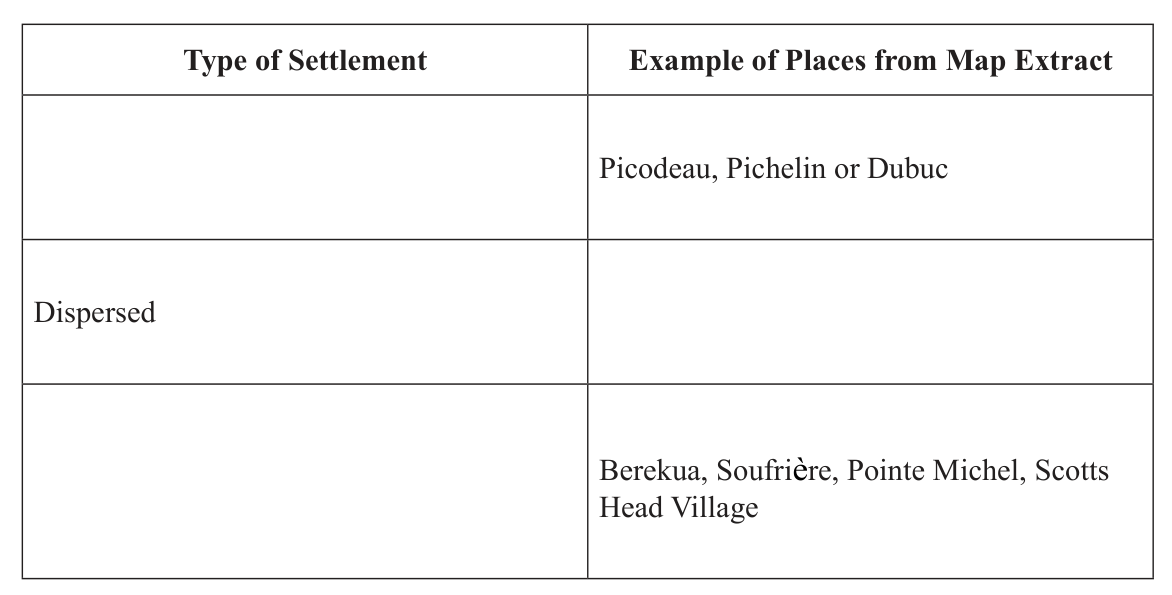
State the six figure grid reference of the church at Berekua (eastern section of the map extract).
[2 marks]
What is the main land use in grid square 7287?
[1 mark]
State the compass direction of the Banana Shed at Geneva Estate (7285) from the church at Berekua.
[1 mark]
Determine the bearing of the trigonometrical station on Morne Plat Pays (6985) from the Banana Shed at Geneva Estate (7285).
[2 marks]
Measure the distance, in km, along the road from the police station at Soufrière (6783) to the road junction at Scotts Head Village (6781) (southwest coast).