CSEC Geography Paper 2 May/June 2021 - Free CXC Past Paper with Answers
Free CXC Geography Paper 2 May/June 2021 past paper from 2021. Includes a worked answer key. Open the PDF, take a timed test, and study with AI on Caribbean AI.
Answer keys are free on Caribbean AI. View the answers to every past-paper question at no cost - no payment needed - with step-by-step worked solutions and instant AI marking available on Premium.
- All CSEC Past Papers
- CSEC Geography Past Papers
- CSEC Geography Paper 2 May/June 2026
- CSEC Geography Paper 2 May/June 2025
- CSEC Geography Paper 2 May/June 2024
- CSEC Geography Paper 2 May/June 2023
- CSEC Geography Paper 2 May/June 2022
- CSEC Geography Paper 2 May/June 2020
- CSEC Geography Paper 2 May/June 2019
- CSEC Geography Paper 2 May/June 2018
- CSEC Geography Paper 2 May/June 2017
- CSEC Geography Paper 2 May/June 2016
- CSEC Geography Paper 2 May/June 2015
- CSEC Geography Paper 2 May/June 2014
- CSEC Geography Paper 2 May/June 2013
- CSEC Geography Paper 2 May/June 2012
- CSEC Geography Paper 2 May/June 2011
- CSEC Geography Paper 2 May/June 2010
- CSEC Geography Paper 2 May/June 2009
- CSEC Geography Paper 2 May/June 2008
- CSEC Geography Paper 2 May/June 2007
- CSEC Geography Paper 2 May/June 2006
- CSEC Geography Paper 2 May/June 2005
CSEC Geography Paper 2 May/June 2021 - Free CXC Past Paper with Answers
Free CXC Geography Paper 2 May/June 2021 past paper from 2021. Includes a worked answer key. Open the PDF, take a timed test, and study with AI on Caribbean AI.
Opening the interactive papers…
- All CSEC Past Papers
- CSEC Geography Past Papers
- CSEC Geography Paper 2 May/June 2026
- CSEC Geography Paper 2 May/June 2025
- CSEC Geography Paper 2 May/June 2024
- CSEC Geography Paper 2 May/June 2023
- CSEC Geography Paper 2 May/June 2022
- CSEC Geography Paper 2 May/June 2020
- CSEC Geography Paper 2 May/June 2019
- CSEC Geography Paper 2 May/June 2018
- CSEC Geography Paper 2 May/June 2017
- CSEC Geography Paper 2 May/June 2016
- CSEC Geography Paper 2 May/June 2015
CSEC Geography Paper 2 May/June 2021 Questions
Every question from this paper as text. See the answers and worked solutions. Questions are the property of the Caribbean Examinations Council; Caribbean AI is not affiliated with CXC.
Question 1 (25 marks)
What is the height of the trigonometrical station in grid square 1915?
[1 mark]
Measure the grid bearing of the roundabout (2611) from the power station at Taylor's (2414).
[2 marks]
Measure the distance along the class A road from the edge of the map at Easting 19 to the point where it crosses the Gillews Gut river. Give your answer to the nearest 100 metres.
[2 marks]
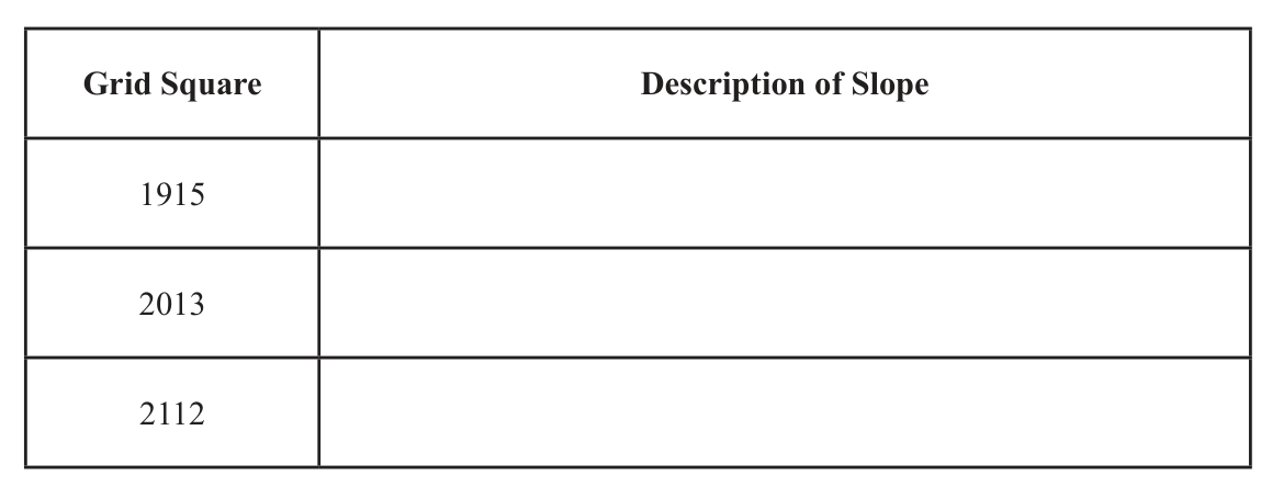
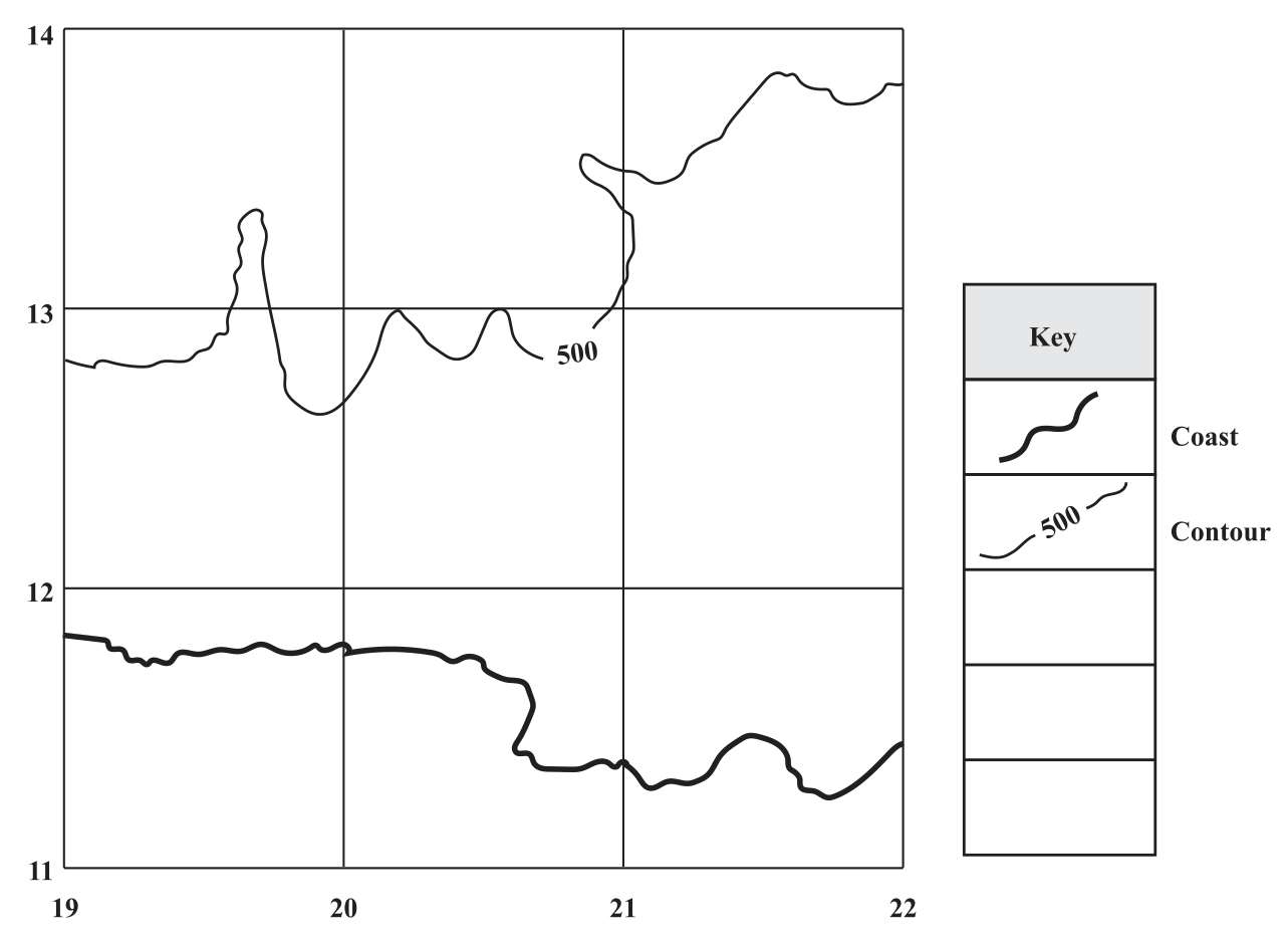
Study the contours in the grid squares given in the table below. Complete the table by using one of the following words to describe the slope of the land in each grid square:
- Gentle
- Moderate
- Steep
| Grid Square | Description of Slope |
|---|---|
| 1915 | |
| 2013 | |
| 2112 |